 Finally.
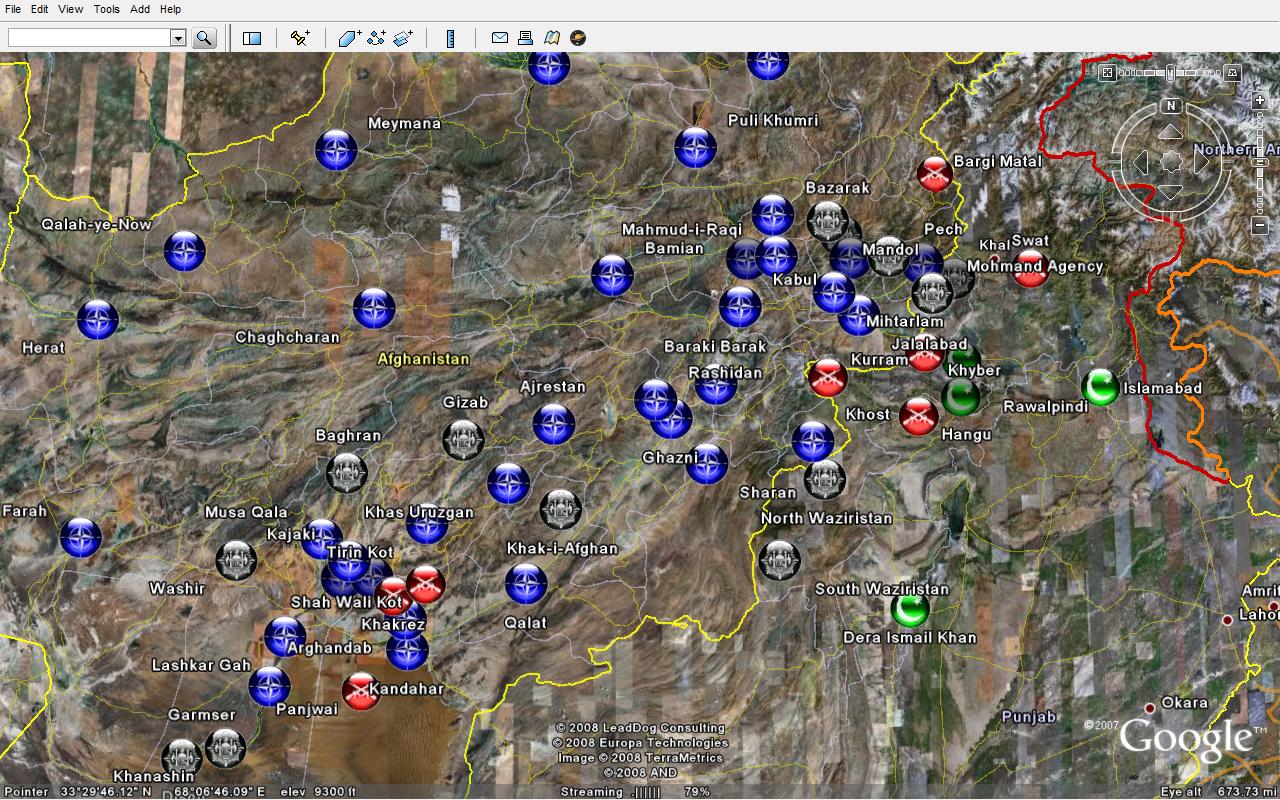
This is a provisional map of who controls which districts in Afghanistan, as of 26 July 2008. The blue icons indicate control by NATO, the United States, and/or the central Afghan government. In order to avoid clutter (and crashing Google Earth), not all of these districts are shown; those that are shown are typically provincial capitals (especially those with Provincial Reconstruction Teams) or districts that the Taliban had controlled in the past. The black icons indicate districts and (and tribal agencies) held by the either the Islamic Emirate of Afghanistan itself or the closely related Tehreek-e-Taliban-e-Pakistan. This set is to the best of my knowledge complete, but bear in mind that this map is a rough draft. The green icons indicate districts and agencies that are held by Pakistan; obviously most such districts are not marked. The red icons indicate districts and agencies that are contested.
For the main image page on Flickr, click here.

No comments:
Post a Comment